
Pinhole Camera Series, Maryville Bridge
Copyright: Contact The Charleston Museum Archives for publication quality images and credit instructions.
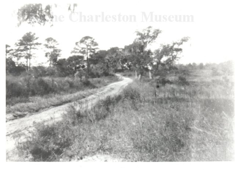
Description:
Black and white photograph of a dirt road leading over a bridge in the area of Maryville in St. Andrews Parish (now West Ashley). Caption with negative reads, "Bridge near Maryville." Printed from a glass plate negative held in the Museum's collection.
Once part of Hillsborough Plantation and consisting of 550 acres in the late 1800s, this area was purchased by Sheriff Christopher C. Bowen from Alice M. Legare in 1879. When the sheriff died just a year later, his widow, Mary R. Bowen subdivided the land and sold a portion to Mary Mathews Just. After the Civil War, Mary Just had found work in the phosphate industry to support her children and wanted an area for the African American community to live. Moving from James Island to her new property, she convinced others to follow and soon the community formed a town and called it "Maryville" in her honor. However, in 1936 the S.C. Legislature revoked the town's charter and St. Andrew's Boulevard (Highway 61) was constructed dividing the small community in half. Today, the neighborhood on the west bank of the Ashley River is known as Ashleyville while the area on the other side of St. Andrew's Boulevard still keeps the name Maryville.
- Title: Pinhole Camera Series, Maryville Bridge
- Photographer: Sams, Franklin Frost (Dr.), 1867-1937
- Date: October 29, 1899
- Collection: Photograph Collection
- Object Name: Franklin Frost Sams Photographs
- Object Id: MK 7675
- Search Terms