
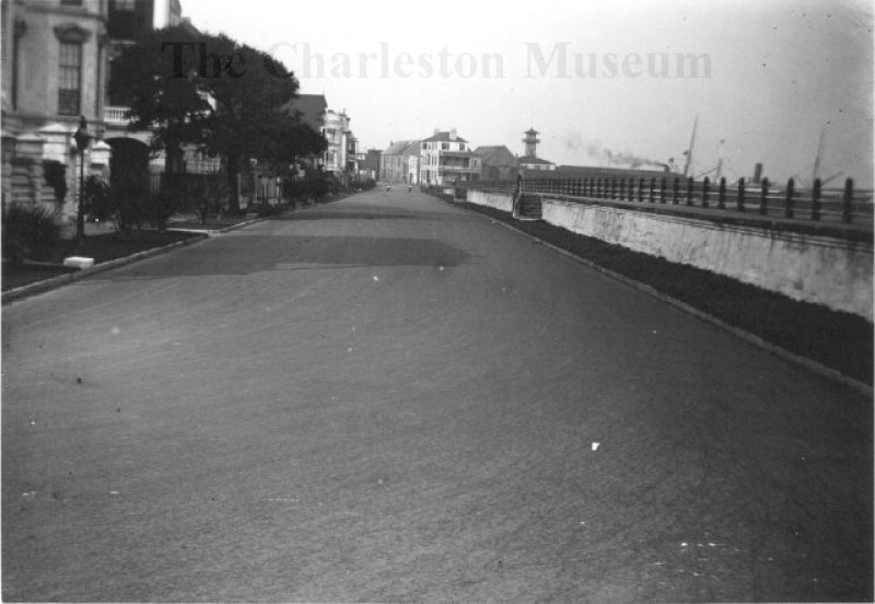
East Battery
Copyright: Contact The Charleston Museum Archives for publication quality images and credit instructions.
Description:
Black and white photograph of East Battery looking north towards East Bay Street before Murray Boulevard was constructed. The seawall is visible on the right running down the entire length of the street to the Missroon House seen at the end. Two figures are walking in the far distance. Printed from a glass plate negative held in the Museum Archives.
In the mid-1700s, this area was made of large earthenworks of mud and sand in which wooden platforms were laid to support cannons. During the War of 1812, cannons were positioned all along this area and is thought to be the reason why it was named "East Battery."
- Title: East Battery
- Photographer: Sams, Franklin Frost (Dr.), 1867-1937
- Date: c.1900
- Collection: Photograph Collection
- Object Name: Franklin Frost Sams Photographs
- Object Id: MK 7487
- Search Terms