New Native American exhibits in the Lowcountry gallery
Martha Zierden, Curator of Historical Archaeology
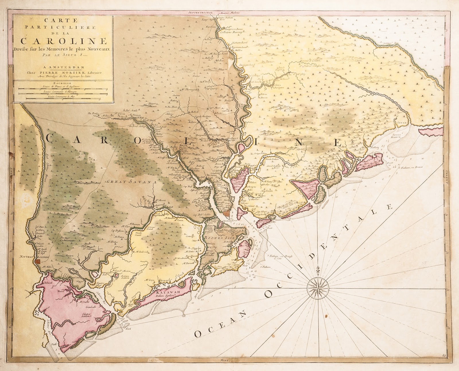 |
| Hand-tinted map of South Carolina coast and inland area, published in 1696 by Nicholas Sanson, a French cartographer. The map, based on the c. 1695 Thornton-Morden map, was first published in Sanson’s Atlas Nouveau Contenant Toutes Les Parties du Monde. It depicts the area from the South Edisto River to the Santee River. Relief shown pictorially, depth shown by soundings and bathymetric shading. Landowners, rivers, creeks, Native American settlements, mountains, and trees are represented. Charleston Museum Archives |
.
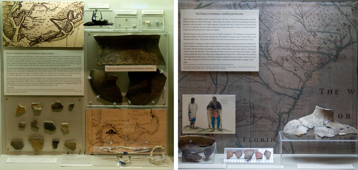
In archaeology, new interpretations usually come from new excavations. But just as often, new interpretations arise from study of old collections – materials excavated or recovered decades ago, preserved in Museum collections. Both are the source of materials featured in new exhibits in our Lowcountry gallery. Recently, our colleagues from across the state, and graduate students at the University of South Carolina, have used the Charleston Museum’s collections (excavated and donated to the Museum throughout the 20th century) to identify pottery types produced by Native residents of the 16th -17th centuries. Their ‘new’ discoveries in ‘old’ collections brought these items out of storage and onto exhibit.
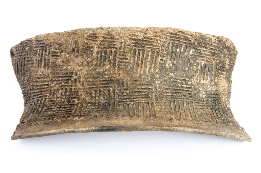
Since installation of the gallery in 1985, archaeologists have identified sites and artifacts relating to the small groups living in the Lowcountry at the time of European arrival, and materials and towns reflecting the movement and upheaval following Spanish and English settlement.Artifacts from recent digs, as well as materials from older Museum collections, can now be identified as Yamasee, a group that migrated to Carolina from Spanish Missions in the 1680s. The Yamasee eventually settled in towns in the Beaufort area. Archaeologists have identified a number of these town sites during survey, and have excavated some in advance of development. Through work of Chester DePratter, Alex Sweeny, Bobby Southerlin, Eric Poplin, and others, we were able to identify Yamasee pottery in our own collections, including a fragment recovered from the Tradd Street redan in Charleston in 2009. More recently, Chester DePratter identified large pottery fragments recovered by divers in the Ashepoo as Yamasee.
 |
| Yamasee pottery, 1686-1690, from the waterfront at Bluff Plantation, Combahee River. Charleston Museum |
.
The research of Jon Marcoux, James Nyman, and John Cable has identified the stamped pottery of 17th century Lowcountry Indians as Ashley series; this ware was first identified by Stanley South at Charles Town Landing in the late 1960s. This pottery has been recovered on our own digs, including the Charleston Museum’s Dill Sanctuary on James Island.
 |
| Kasita Red Filmed pottery from Stono Plantaton, Dill Santuary, James Island. Excavated from early 18th century contexts. Charleston Museum |
.
Not all pottery recovered here was from local groups. We have identified pottery associated with the peoples eventually identified as Creeks in central Alabama. Creek pottery of the late 17th-early 18th century was recovered at the Lord Ashley site, Dill Sanctuary, and even our Heyward-Washington House!
All of these wares are now on permanent display. We would like to thank our colleagues, Jon Marcoux, Chester DePratter, Eric Poplin, Charlie Phillips, and Chris Judge for their expertise and guidance, and for suggested maps and illustrations. We also added images of archaeological sites to the Mississippian and Woodland exhibits. Thanks to Chris Judge, Sean Taylor and South Carolina Wildlife Magazine for sharing those images.