
Forces of Nature: Charleston in the Aftermath
PAST EXHIBIT
Many meteorological and geological forces of nature have impacted Charleston and the surrounding coastal areas over the years. Luckily, a handful of photographers braved these forces of nature to chronicle the aftermath.
Hurricane Force
The cyclone of 1885 hit Charleston in late August with estimated winds of 125 miles per hour and for the next 103 years, the city would endure more than thirty tropical cyclones, major storms, and hurricanes.
 1885 Category 2 Hurricane, South Battery, George Smith Cook (1819-1902)
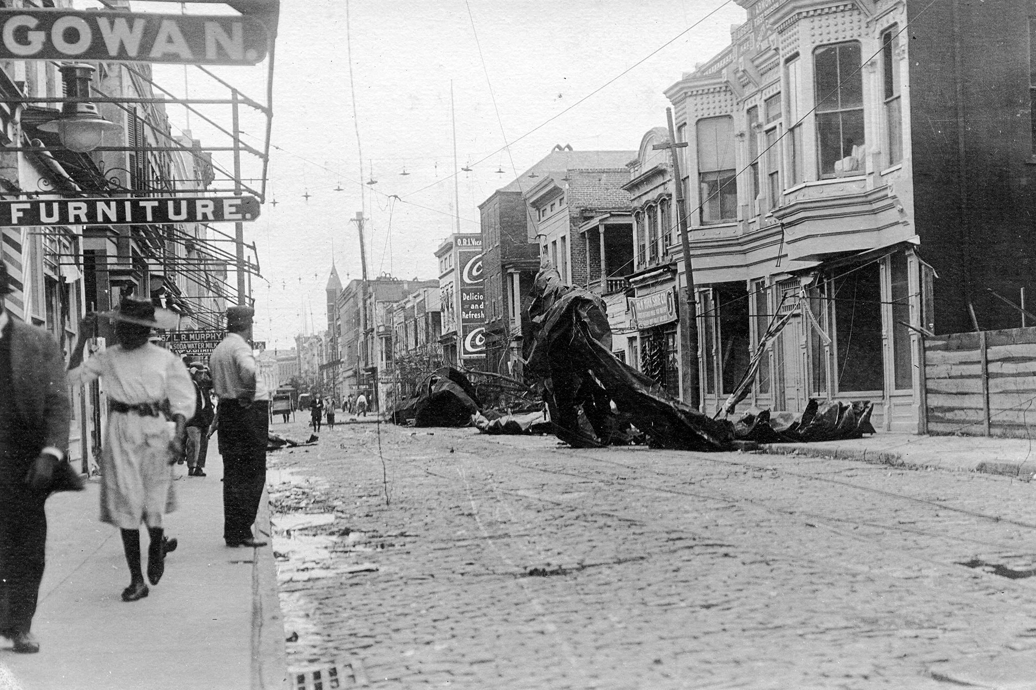
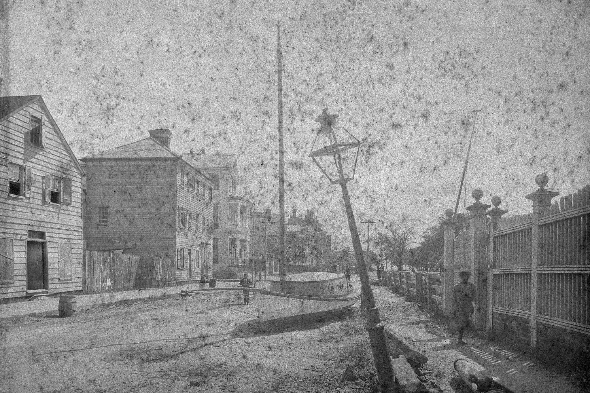
1916 Category 2 Hurricane, King Street, unknown photographer
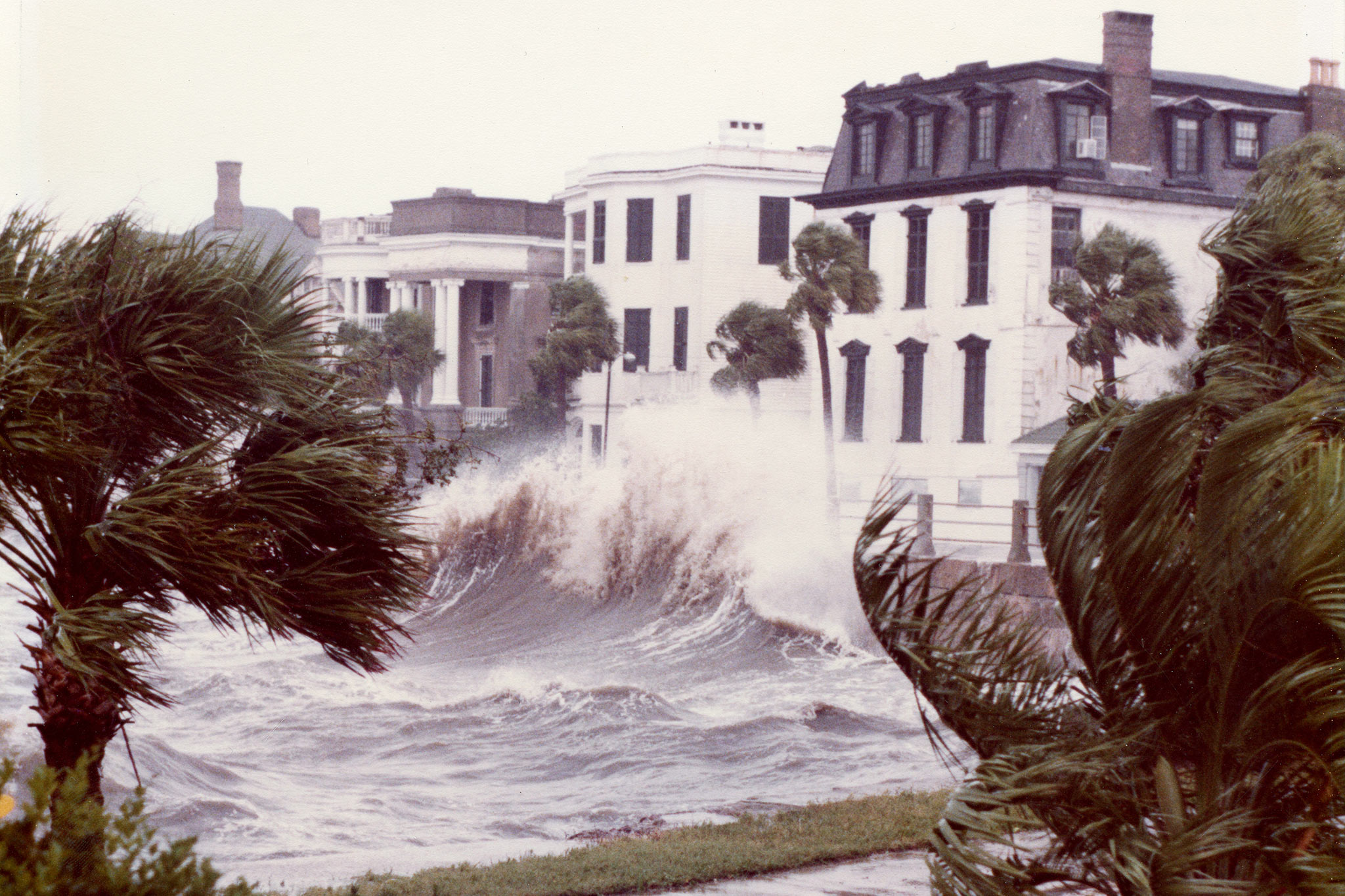
Among the hurricanes, Hugo caused the most devastation. Reaching Category 5 intensity, it made landfall as a Category 4 hurricane on September 22 of 1989 with winds of 135-140 miles per hour.
1989 Hurricane Hugo, Hayne Street, John Kenneth Jones (1945-2014)
Earthquake Force
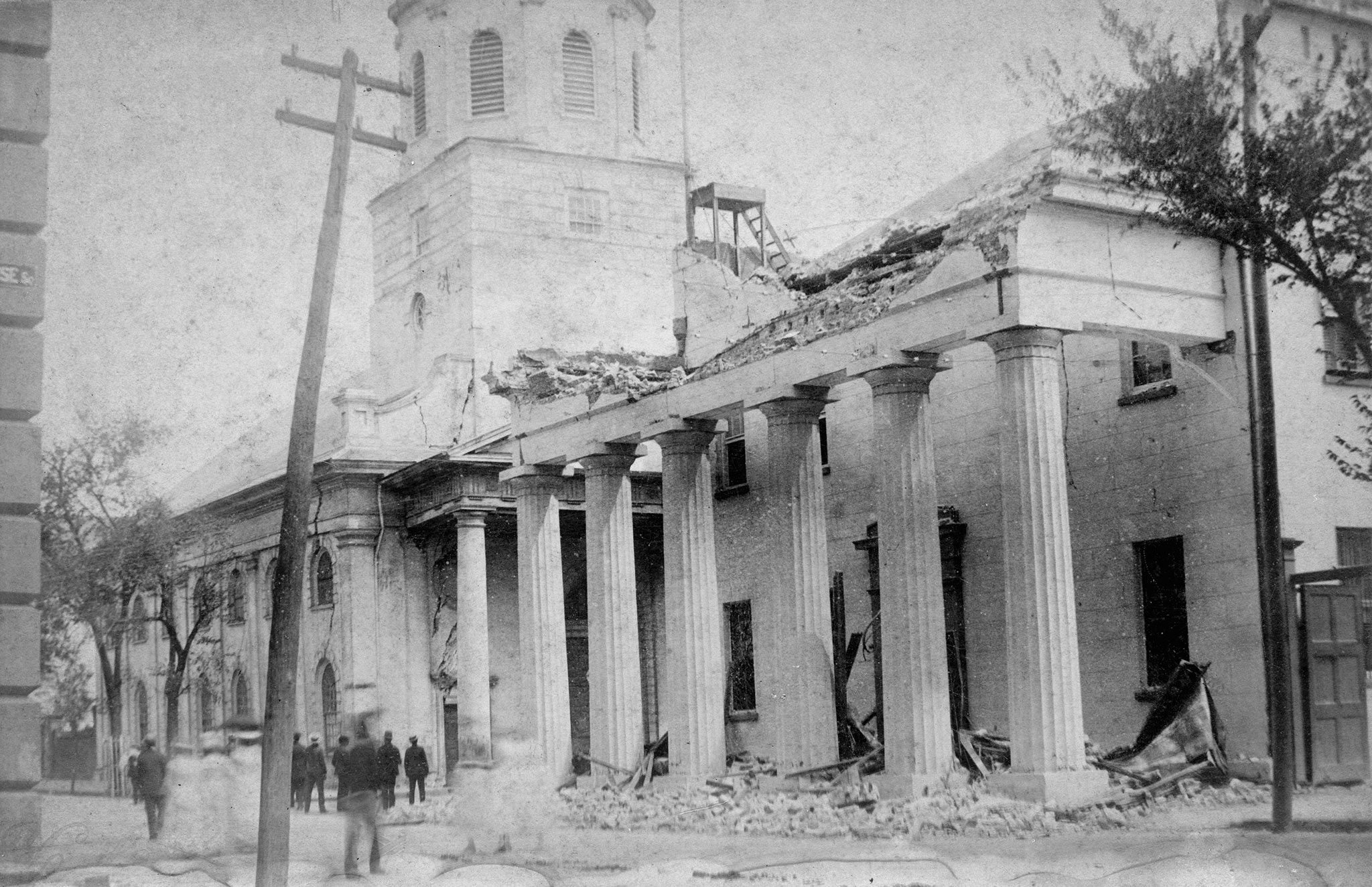
Sometime around 9:50 p.m. on August 31, 1886, an earthquake, unparalleled in scale, began to shake Charleston. Felt as far away as Ohio and Alabama, it is today estimated to have had a magnitude of 7.6 on the Richter scale. Lasting only 60 seconds, the structural damage that occurred throughout the peninsula, from private homes to public buildings and churches, totaled over $5 million dollars in damages.
Police Station at the corner of Broad and Meeting Streets, George L. Cook (1849-1919)
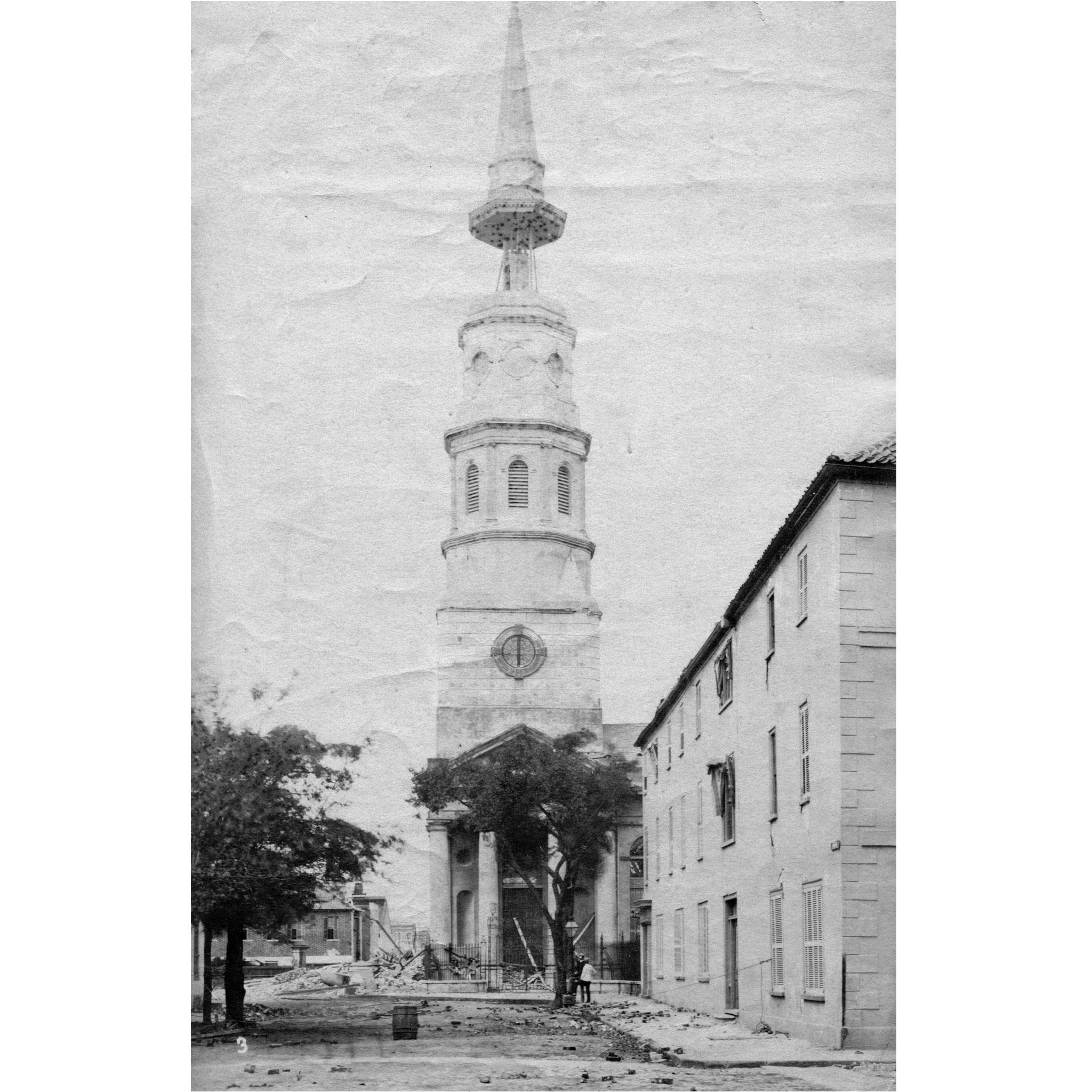
St. Philip’s Episcopal Church, 142 Church Street, George L. Cook (1849-1919)
Outside of town, land deformations and liquefaction occurred creating small holes and craterlets from which blue mud and multi-colored sands discharged.
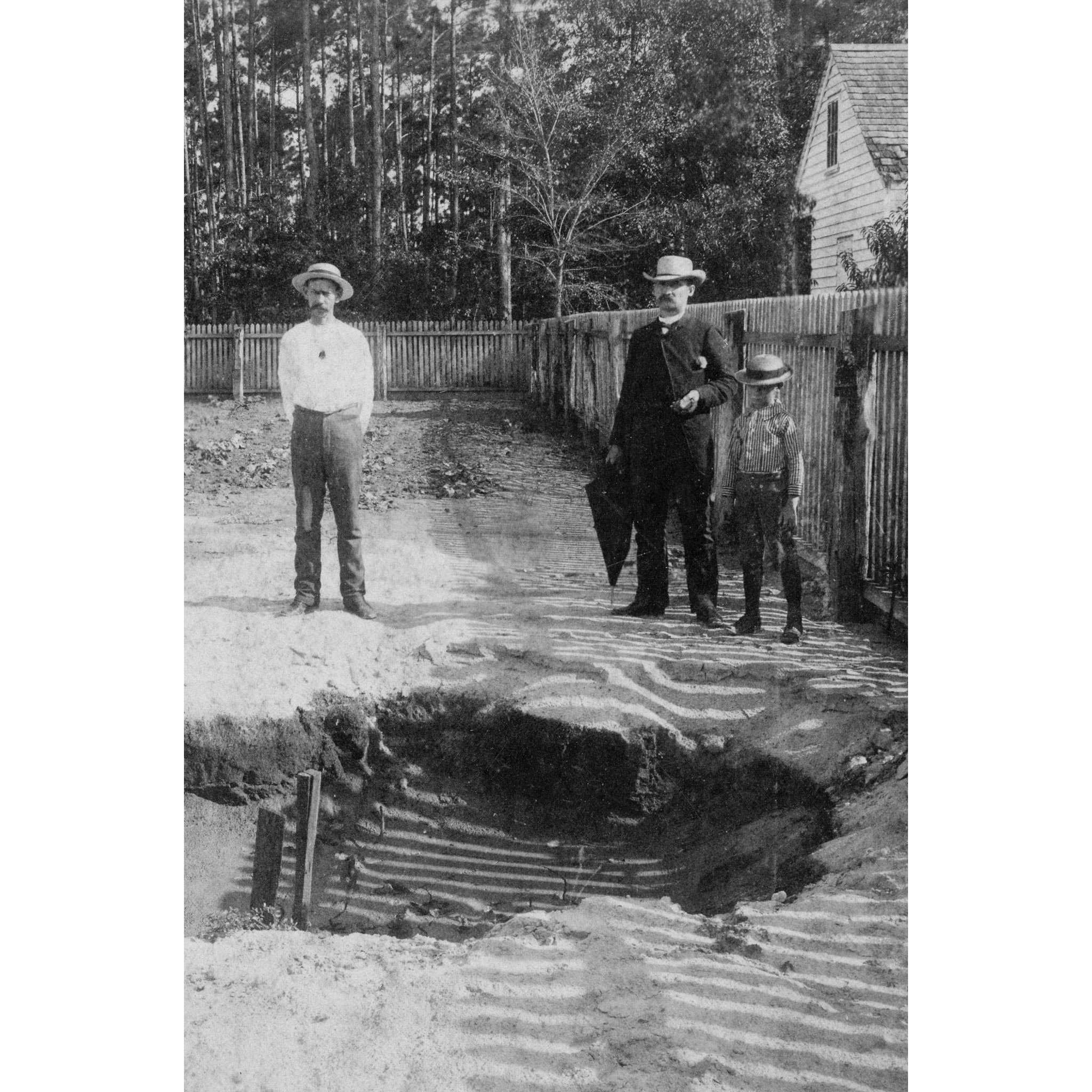
Two Foot Fissure, Oak Grove, South Carolina, George L. Cook (1849-1919)
Tornado Force
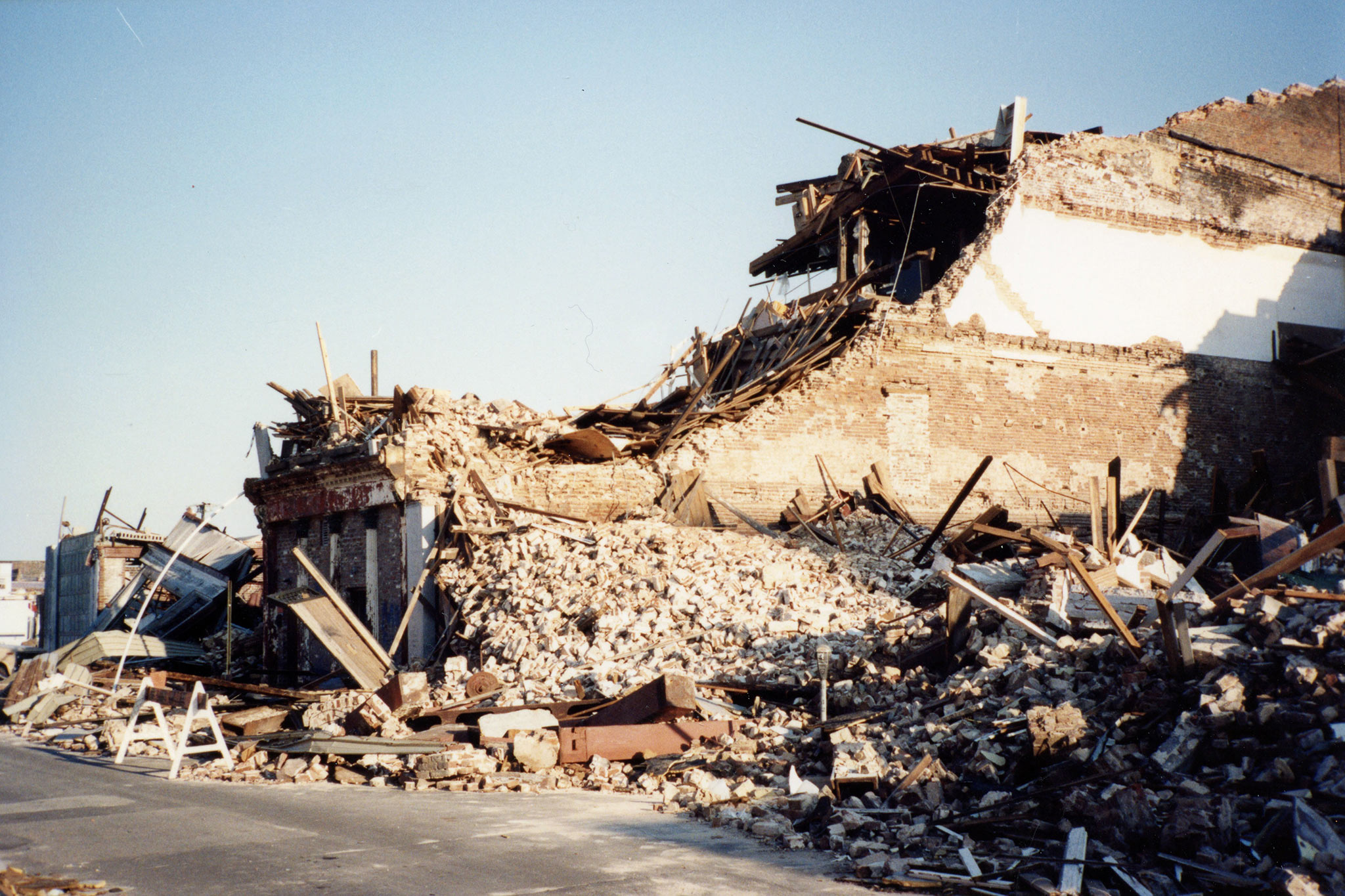
On September 29, 1938, an unprecedented five tornadoes struck the South Carolina Lowcountry. Generated by a tropical depression that formed in the Gulf of Mexico two days earlier, the five twisters hit Charleston and the surrounding islands between 7:50 and 8:30 in the morning. Two of the tornadoes, ranked F2, ravaged the peninsula, where 32 people died and close to 200 homes and businesses were completely destroyed. The other three, ranked F1, swept through James Island, Sullivan’s Island and other outlying areas, leaving a dreadful path of destruction in their wake. Heavy rains and higher than normal tides, brought on by the tropical depression, frustrated clean up efforts, and property damage was estimated at over $2 million.
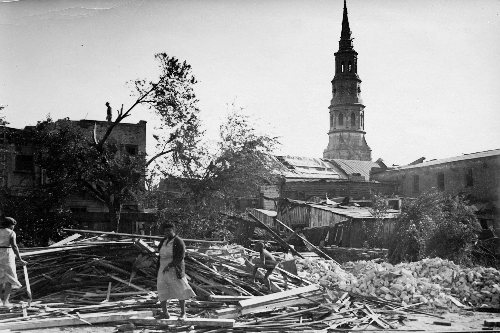
Cumberland Street, Morton Brailsford Paine (1883-1940)
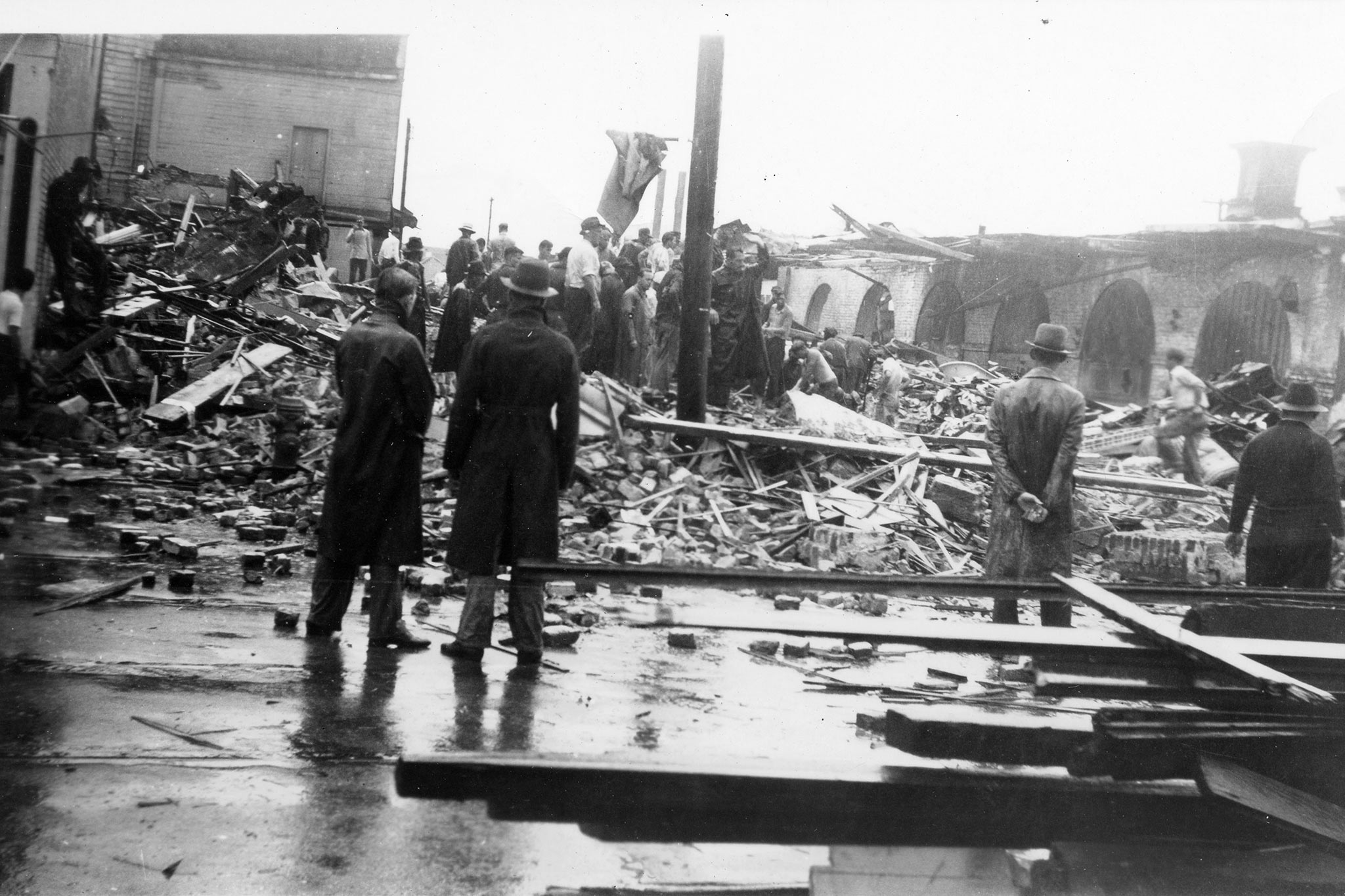
Corner of Market & East Bay Streets, Jesse Sharpe
As you walk the streets of Charleston today, little evidence of the destruction caused by past hurricanes, tornadoes, and the 1886 Earthquake can be seen. Debris has been cleared, buildings have been rebuilt, trees replanted, and earthquake bolts put into place. The people of our city have continued to remain strong in the midst of storms as well as the aftermath.